1.4 KiB
1.4 KiB
Routes for walking to school
This script generates maps to analyze the potential walking routes for students to their school.
- I excluded the addresses of the students from the repository.
- The actual route generation is done with OSRM, I run it locally in a docker container.
- The basemap is pulled from Stadia Maps. The usage of the script is well within the free tier, you'll need an API key from them.
Data sources
- School location data is from: https://data-wi-dpi.opendata.arcgis.com/
- Madison Bike Level of Traffic Stress is from: https://data-cityofmadison.opendata.arcgis.com/datasets/cityofmadison::bike-lts/explore
- Student addresses provided by school.
Example figures
This script will generate a few figures:
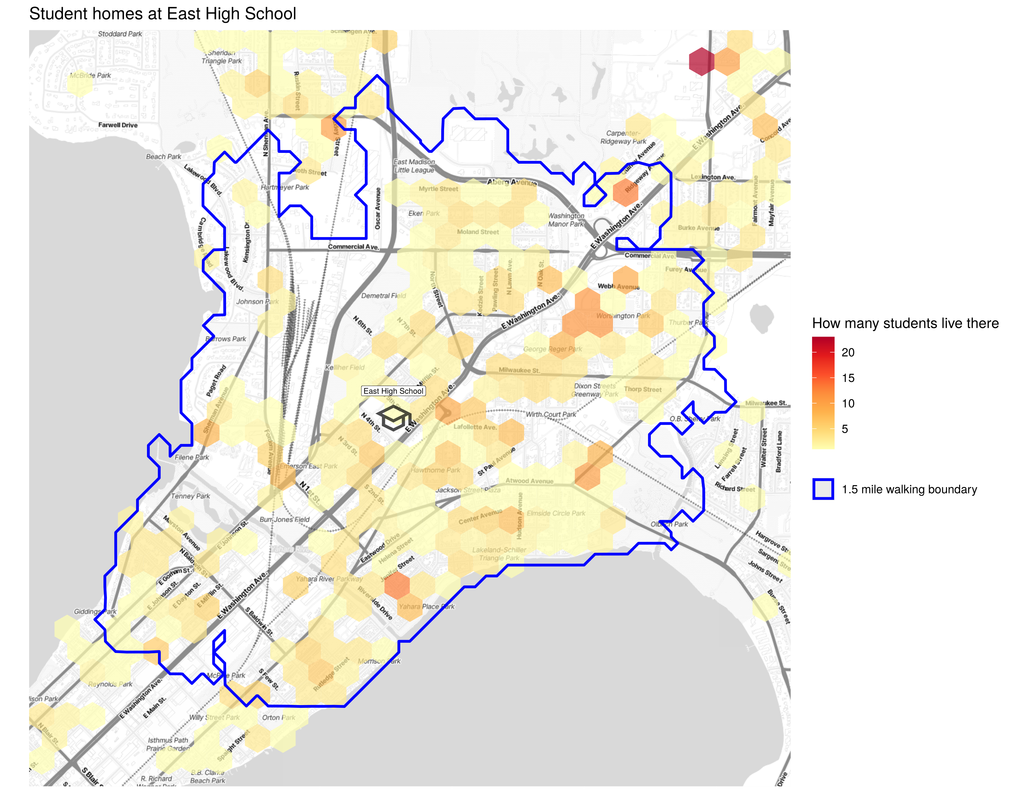
A heatmap of student addresses:
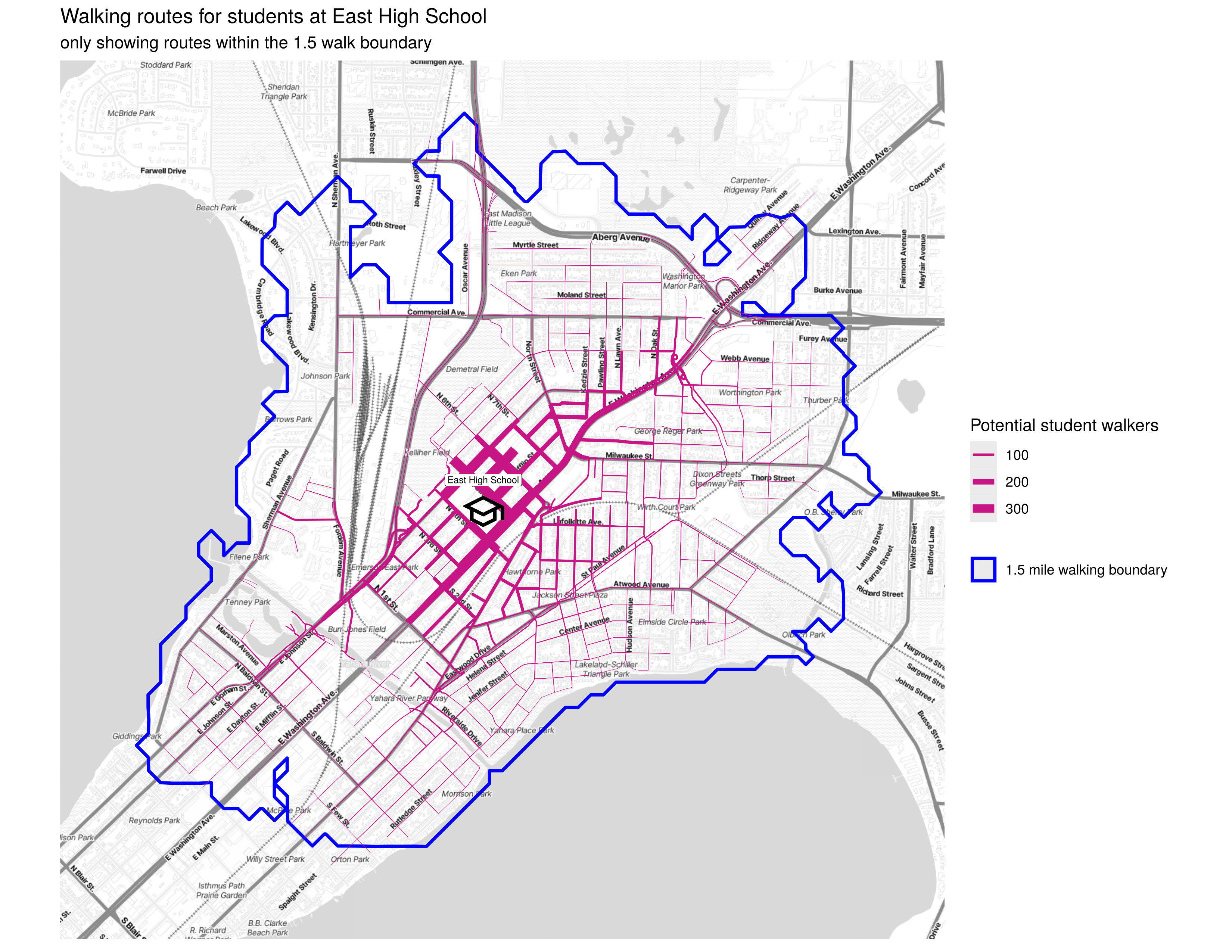
A map of all the walking routes within the walk boundary:
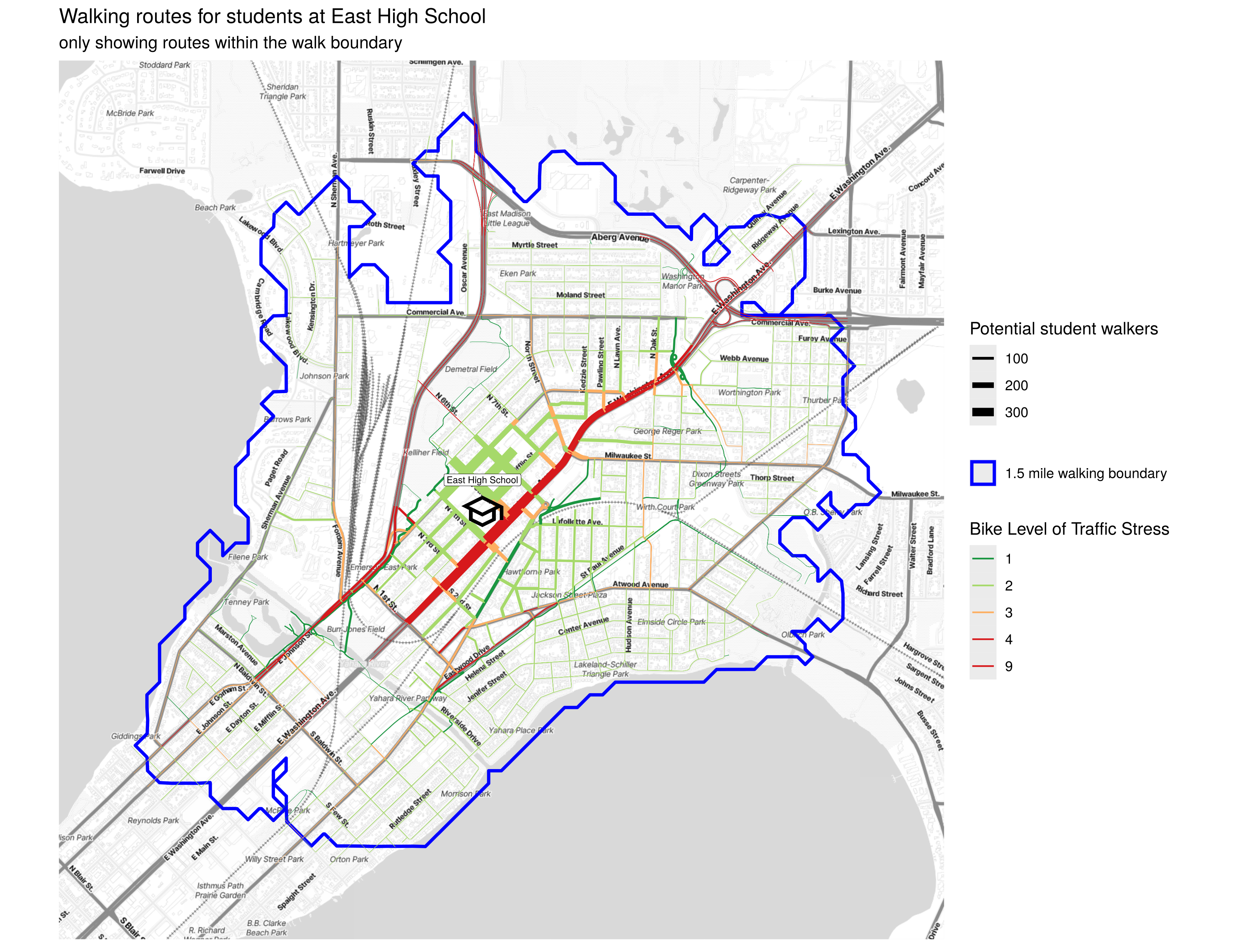
A map of those routes colored by the level of traffic stress to bike
Using make
The command make route_analysis will run route_analysis.Rmd which
is an R markdown file containing the original R script route_analysis.R