No description
|
|
||
|---|---|---|
| archive | ||
| docker | ||
| examples | ||
| html | ||
| other | ||
| R | ||
| .gitignore | ||
| cycling_route_analysis_brouter.Rmd | ||
| LICENSE | ||
| Makefile | ||
| README.md | ||
| route_analysis.Rmd | ||
| WI-schools-cycle.Rmd | ||
Routes for walking to school
This script generates maps to analyze the potential walking routes for students to their school.
- I excluded the addresses of the students from the repository.
- The actual route generation is done with
brouter(using the safety profile) andOSRM(for the boundary polygons), those are run locally in docker containers. - The basemap is pulled from Stadia Maps. The usage of the script is well within the free tier, you'll need an API key from them.
Data sources
- School location data is from: https://data-wi-dpi.opendata.arcgis.com/
- Madison Bike Level of Traffic Stress is from: https://data-cityofmadison.opendata.arcgis.com/datasets/cityofmadison::bike-lts/explore
- Student addresses provided by school.
Example figures
This script will generate a few figures:
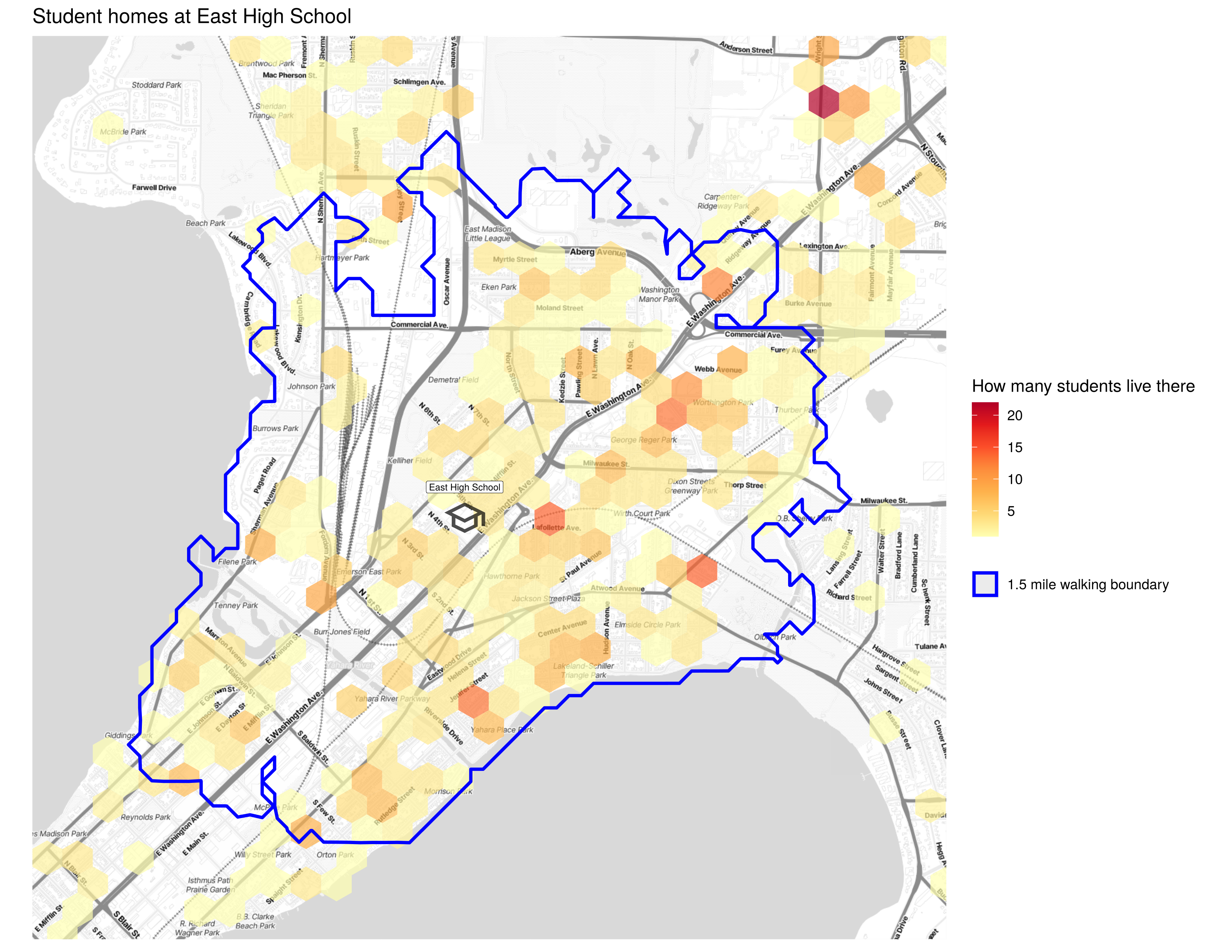
A heatmap of student addresses:
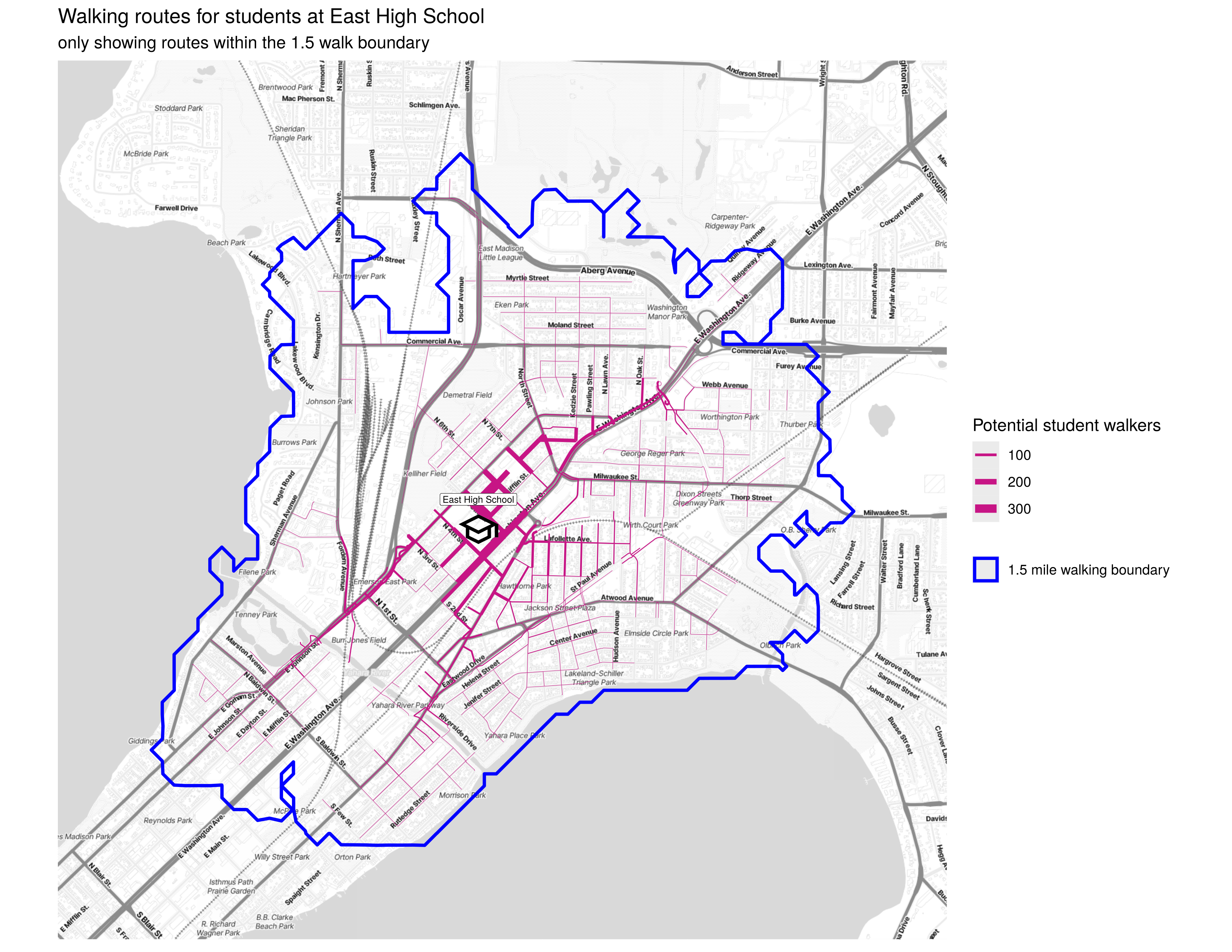
A map of all the walking routes within the walk boundary:
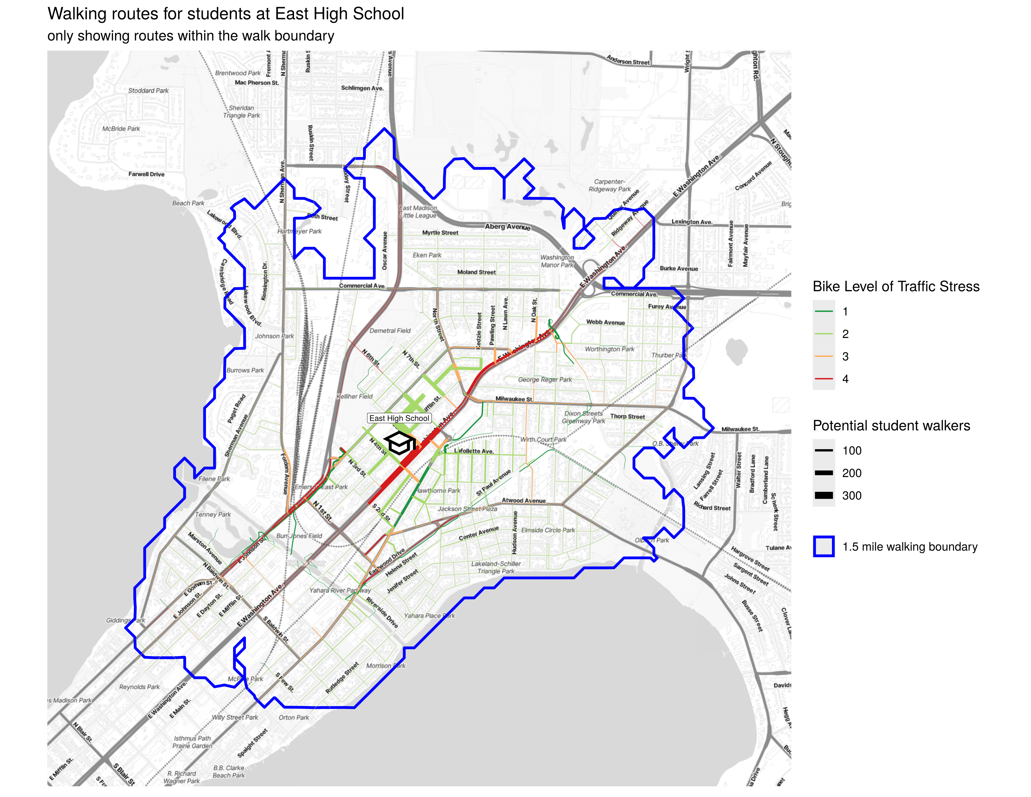
A map of those walking routes colored by the level of traffic stress to bike
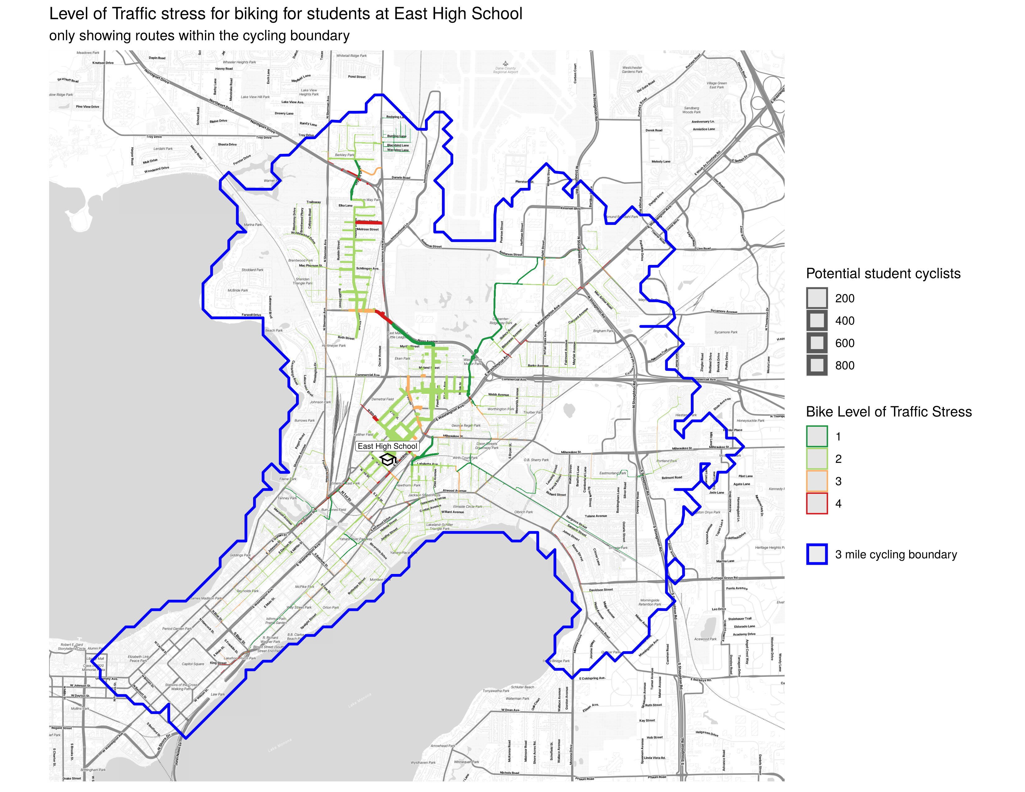
A map of cycling routes colored by the level of traffic stress to bike (with a 3 mile radius)
Using make
make osrm-data: downloads the OpenStreetMap data for Wisconsin, and preproccesses it for use with OSRM.make osrm-container: starts the OSRM containers (backends and frontends) for walking and biking.make brouter-data: clones the repositories for brouter and brouter-web and downloads the segment data. It also builds the docker images for brouter and brouter-web.make brouter-container: starts the brouter containers (backend and frontend).make walkwill run route_analysis.Rmd which calculates the walking routes using OSRM.make cycle-osrmwill run cycling_route_analysis.Rmd which calculates the biking routes using OSRM.make cycle-brouterwill run cycling_route_analysis_brouter.Rmd which calculates the biking routes using brouter.
What-if analysis
This allows you to make changes to the street network (add a bike path, reduce a lane on an arterial street) and see how it affects the routes that brouter chooses.
This is a multi-step process:
- Generate an OsmChange file for the changes that you want to analyze. Don't upload your hypothetical infrastructure to OpenStreetMap!
- Save that file as
docker/brouter/osm_edit/changes.osc. make osm_edit_refresh_basewill download a fresh copy ofwisconsin-latest.osm.pbfand the elevation tiles for Wisconsin. You don't need to run this frequently.make osm_edit_generate_pbfwill take those edits and apply them to thewisconsin-latest.osm.pbfand generatewisconsin-latest_edited.osm.pbfmake osm_edit_generate_brouterwill generate new brouter segment files from the edited pbf file.make osm_edit_brouter_containersstarts the brouter backend and frontend using your newly created segment files with the edits you made. You can access the webui at http://127.0.0.1:8080